


The United Nations General Assembly has overwhelmingly backed a Togo-led resolution calling for a more accurate representation of the world’s continents, particularly Africa, on global maps.
The resolution, “Correct the Map: Rebalancing Global Cartographic Representation and Promoting Equitable Representation of the World’s Regions, Particularly Africa,” was adopted on Friday, September 4, with 164 countries voting in favour, six abstaining and only the United States voting against. 
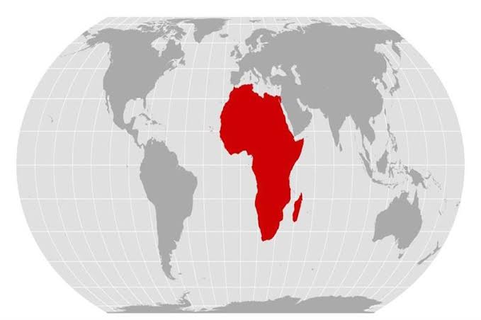
The initiative promotes the gradual adoption of the Equal Earth projection, which represents the relative areas of continents more accurately than the centuries-old Mercator projection. The Mercator map, developed in 1569 primarily for navigation, significantly enlarges landmasses closer to the poles while making equatorial regions such as Africa appear disproportionately smaller.
Togo, which spearheaded the initiative with African Union backing, argued that maps are not merely geographical tools but also shape how societies perceive the world and their place in it.
The resolution is not legally binding and does not ban the Mercator projection, which remains useful for maritime navigation. Instead, it encourages governments, educational institutions and other users to consider more geographically accurate alternatives.
The vote also exposed differing political interpretations of the initiative. The United States was the sole country to oppose the resolution, arguing that the United Nations should concentrate on more pressing global challenges rather than what Washington characterised as an ideological agenda.
The measure nonetheless represents a significant diplomatic victory for African countries seeking to challenge longstanding distortions in the way the continent is visually represented on commonly used world maps.
Africa has not changed its size. The map is finally being asked to show it.